Product Introduction
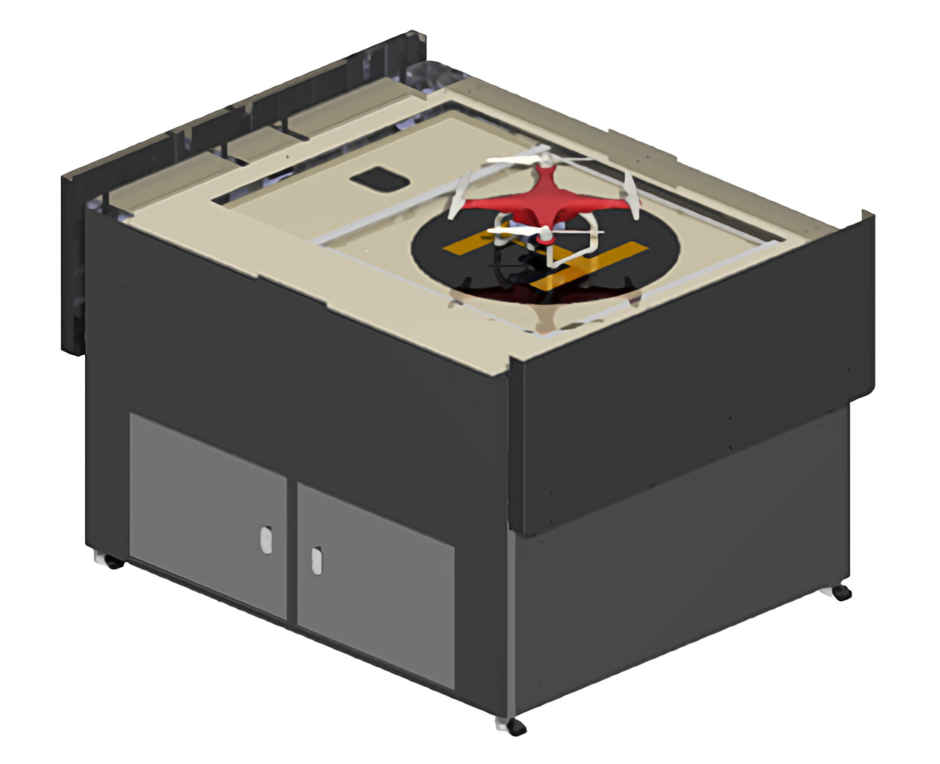
Drone Control Station - NS Station
Drone Control Station
- NS Station
- NS Station
To prevent drone crashes and ensure safe flights,
"Drone Integrity Management Technology" is applied to
the Drone Control Station
"Drone Integrity Management Technology" is applied to
the Drone Control Station
Drone Integrity Management
Drone Mission Management
To prevent drone crashes and ensure safe flights,
"Drone Integrity Management Technology" is applied to
the Drone Control Station
"Drone Integrity Management Technology" is applied to
the Drone Control Station
Drone Integrity Management
Drone Mission Management
Product Description
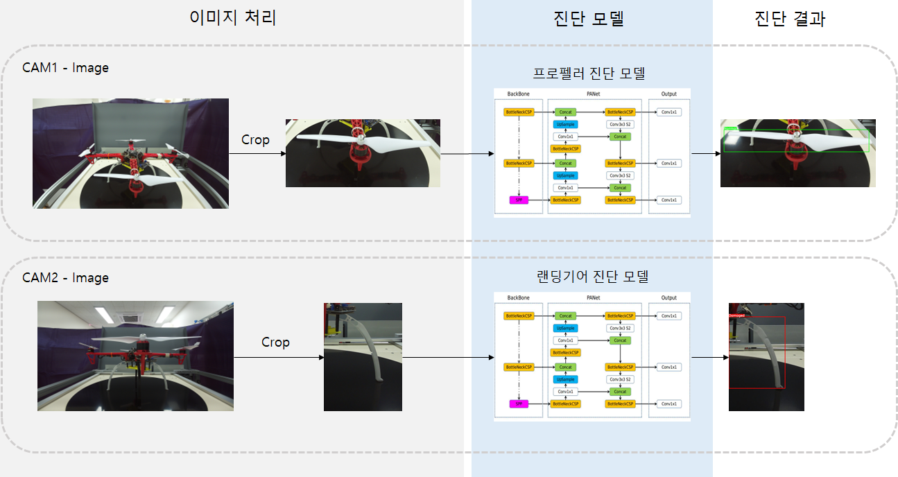
Drone Integrity Management
Integrity management technology includes three main functions: fault detection, fault diagnosis, and fault prediction and prevention.
It manages internal and external components of drones throughout the entire operation cycle before, during, and after flights,
thereby improving the operational stability and availability of drones.
NSquare's integrity management technology is based on flight data and image defect detection technology,
providing features such as determining flight feasibility, diagnosing flight data and external defects, and suggesting the optimal timing for component replacement based on the drone's operational status.
Fault Detection
Monitors images of the drone's exterior or flight data to recognize abnormalities or defects in components.
Fault Diagnosis
Identifies the location of detected faults and evaluates their severity.
Fault Prediction and Prevention
Predicts fault occurrence timing based on fault diagnosis results. It also suggests or implements measures to prevent crashes in the current state.
Before Drone Flight
During Drone Flight
After Drone Flight
Review flight plan
System check and checklist display
Determine flight feasibility
Provide causes and solutions for non-feasibility
Real-time fault detection based on flight data
- Detect abnormal battery voltage
- Detect flight path deviation
- Detect communication signal loss Diagnose flight data Emergency drone return functionality
- Detect abnormal battery voltage
- Detect flight path deviation
- Detect communication signal loss Diagnose flight data Emergency drone return functionality
Image-based external defect detection
Diagnosis of exterior images and flight data
Display required maintenance items
Display defects and remaining lifespan for each component
Suggest optimal component replacement timing
Provide tailored functionality based on drone operation status
Functions are provided according to the current operation status of the drone.
Drone Mission Management
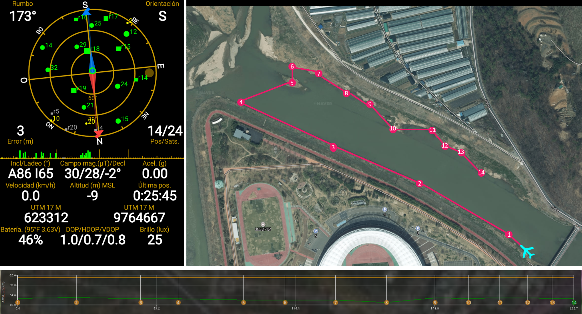
Support for Autonomous Flight Planning
Establish flight schedules by setting latitude, longitude, and altitude,
or plan autonomous flights using 3D grid or waypoints.
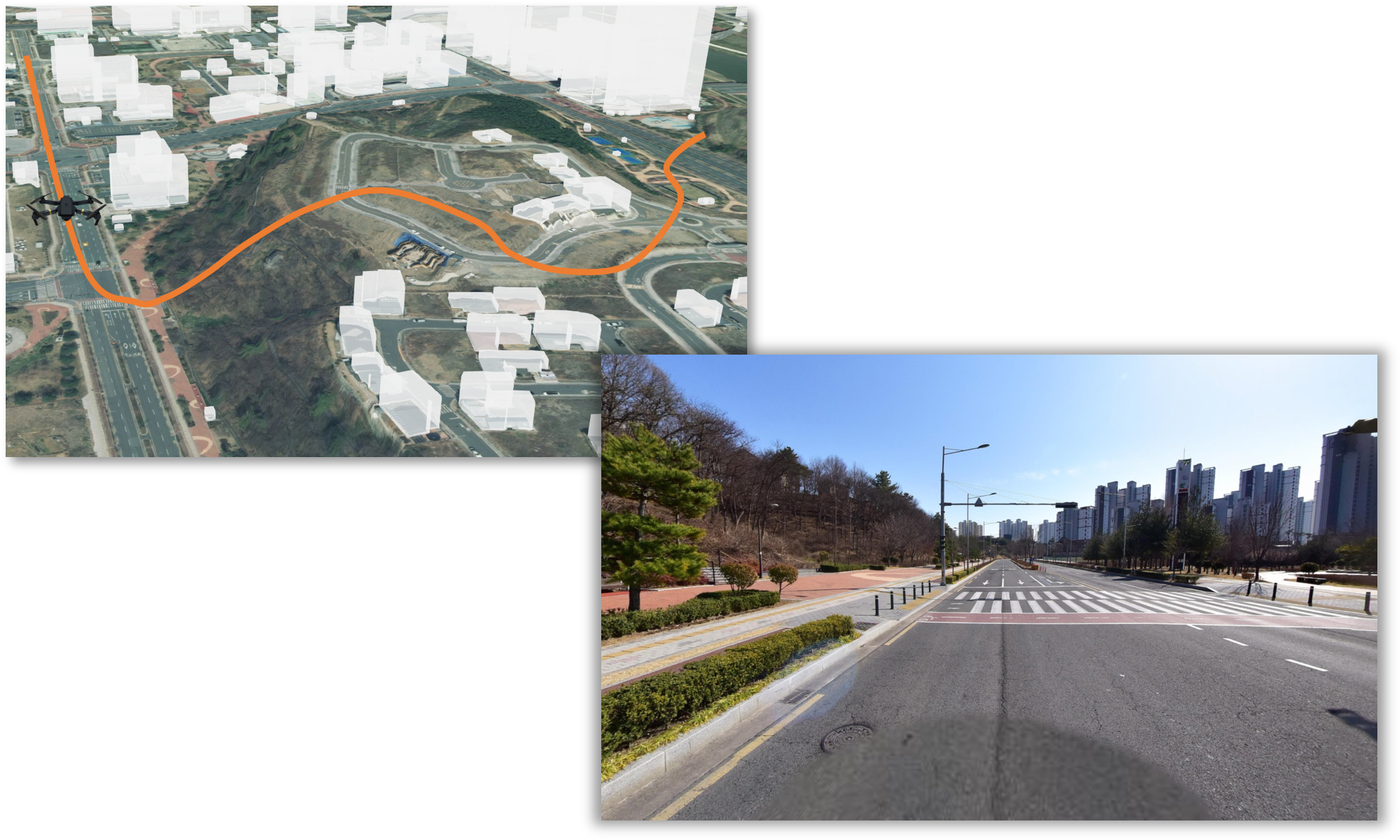
Autonomous flight planning uses data from LiDAR sensors attached to the drone or generates 3D map data, enabling safe and efficient autonomous flight through grid-based algorithms.
Autonomous flight planning uses data from LiDAR sensors attached to the drone or generates 3D map data, enabling safe and efficient autonomous flight through grid-based algorithms.
Flight Control and Remote Monitoring
Control the drone's flight and emergency situations, and display its location and operational path on a 3D spatial map,
allowing users to monitor if the drone is following the correct path.
Additionally, real-time flight video streaming enables users to observe the surroundings of the drone, even from remote locations, providing insights into the environment around the drone.
Additionally, real-time flight video streaming enables users to observe the surroundings of the drone, even from remote locations, providing insights into the environment around the drone.
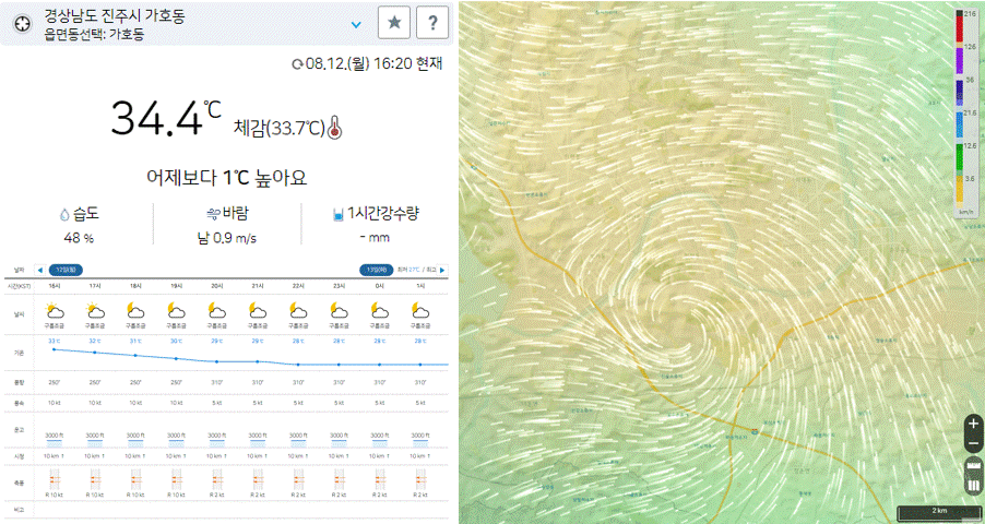
Provide Flight Environment Information
Since drones are heavily influenced by weather conditions,
understanding the surrounding flight environment is crucial for safe operations.
By integrating with real-time weather information systems such as meteorological services, it provides current and near-future weather information necessary for understanding the flight environment.
By integrating with real-time weather information systems such as meteorological services, it provides current and near-future weather information necessary for understanding the flight environment.
Wind Direction and Speed
Hourly Precipitation
Temperature
Humidity
Product Specifications
- Hardware -
Power
220V
Storage Type
Top-opening drone storage type
Number of Stored Drones
1
Dimensions
W1240 x D 1020 x H1250 (mm)
Weight
150kg
- Software -
Supported Data File Formats
Exterior Images
All image file formats supported
Flight Data
.csv, .json
Detection and Analysis Data
Exterior Images
Propellers
Landing Gear
Flight Data
Battery Voltage
Weather Information Data
Wind Direction (˚)
Wind Speed (m/s)
Precipitation (mm)
Temperature (℃)
Humidity (%)